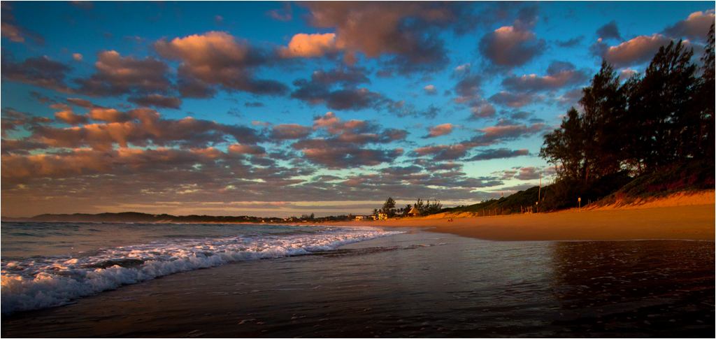
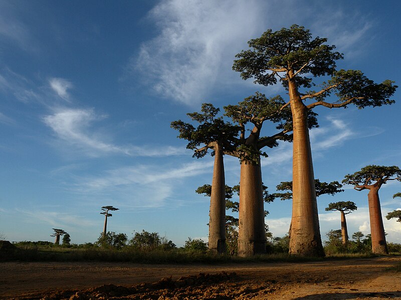
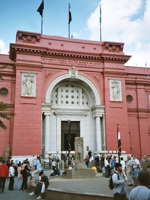
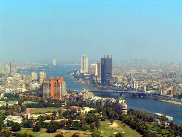
The city of Cairo has a hot desert climate, meaning it has a hot, sunny, and dry climate a year long. The city, however, has more humidity than other cities with the hot desert climate
2. South Africa
The Republic of South Africa is a country in the southern region of Africa. About fifty-seven million people live there. South Africa is next to Namibia, Botswana, Zimbabwe, Mozambique, Lesotho, and Swaziland. The biggest city in South Africa is Johannesburg. The country has three capitals for different purposes. They are Cape Town, Pretoria, and Bloemfontein. This is because the government is based in Pretoria, the parliament is in Cape Town and the Supreme Court is in Bloemfontein.
There are 11 national languages. They are Afrikaans, English, Ndebele, Xhosa, Zulu, Swati, Setswana, Sesotho, Sesotho sa Leboa, Venda, and Tsonga. They are also known as National Lexicography Units (NLUs). Because of all the languages, the country has an official name in each language
 |
| Drakensberg mountains |
South Africa is ranked sixth out of the world’s 17 megadiverse countries, with more than 20,000 different kinds of plants, or about 10% of all the known species of plants on Earth, making it very rich in plant biodiversity.
The most common biome in South Africa is the grassland, mostly on the Highveld. This is where grasses, low shrubs, and acacia trees, mostly camel-thorn and whitethorn are more common than plants
 |
| Traditional South African cuisine |
 |
| Waterfront harbor of Cape Town, South Africa |
The Cape of Good Hope is a place near the far south end of Africa, where the Atlantic Ocean and the Indian Ocean meet. It is a well-known area for ships that pass in the sea between southern Africa and Antarctica. It is in the Western Cape Province of South Africa and forms part of the Table Mountain National Reserve.
The first person from Europe to see it was the Portuguese man Bartolomeu Dias. He saw it in 1488 and named it the "Cape of Storms".
 |
| The Cape of Good Hope |
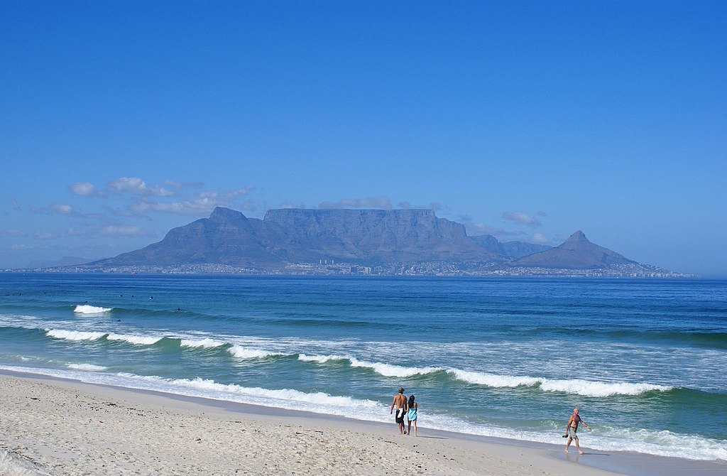 |
| table Mountain is flanked by Devil's Peak, left, and Lion's Head, right. |
3. Victoria Falls
Victoria Falls is a waterfall in south-central Africa in the Zambezi River between southeast Zambia and northwest Zimbabwe. It is 108.3 m high and 1,703 m wide.
The falls were discovered by David Livingstone in November 1855, where he viewed them on what is now known as Livingstone Island. He named it after Queen Victoria. The Chitonga name for the Falls is Mosi-oa-Tunya. That word means "the smoke that thunders." They call it that because the Falls are very misty. It is listed as one of the UNESCO World Heritage Sites.
 |
| Victoria Falls |
4. Zanzibar
Zanzibar is an autonomous region of Tanzania. It is composed of the Zanzibar Archipelago in the Indian Ocean, 25–50 kilometers
(16–31 mi) off the coast of the mainland, and consists of many small islands and two large ones: Unguja (the main island, referred to informally as Zanzibar) and Pemba Island. The capital is Zanzibar City, located on the island of Unguja. Its historic center is Stone Town, a World Heritage Site.
 |
| A panorama of Stone Town. Seen in the picture are the Sultan's palace, House of Wonders, Forodhani Gardens, and St. Joseph's Cathedral |
Zanzibar's main industries are spices, raffia, and tourism. In particular, the islands produce cloves, nutmeg, cinnamon, and black pepper. For this reason, the Zanzibar Archipelago, together with Tanzania's Mafia Island.
 |
| A beach on Zanzibar |
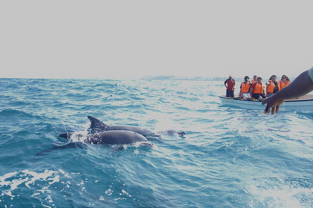 |
| dolphins in the Indian Ocean near Zanzibar |
 |
| The Coastline of Zanzibar. |
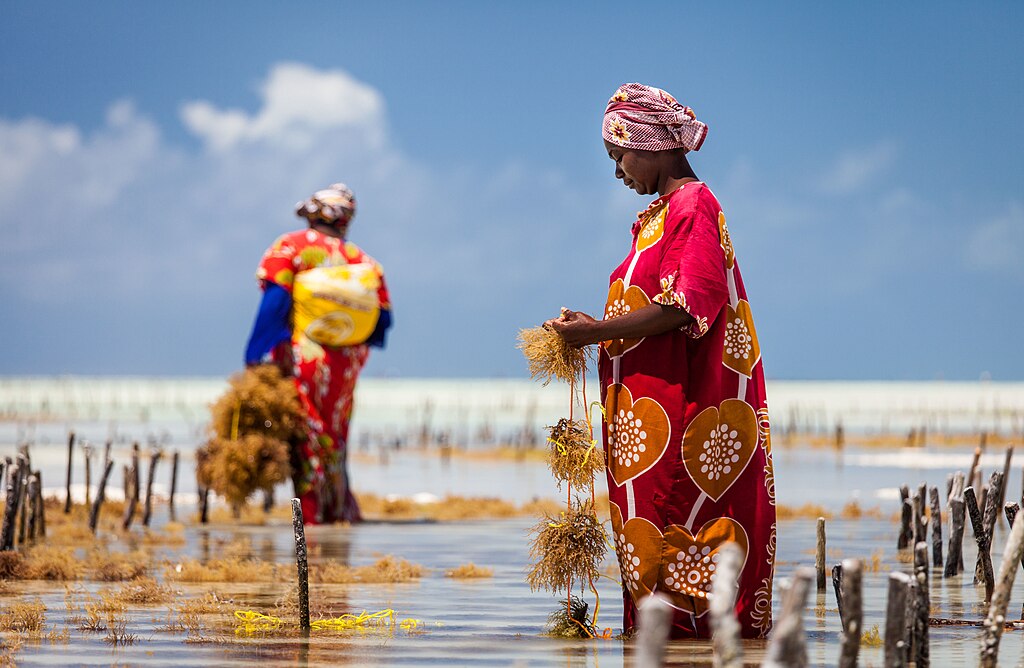 |
| Seaweed farming in Jambiani |
.jpg/1024px-Low_Tide_(7886864976).jpg) |
| Tourism is one of the main sectors of the economy |
5. Serengeti National Park (Tanzania)
The Serengeti National Park is a Tanzanian national park in the Serengeti ecosystem in the Mara and Simiyu regions. It is well-known for its annual migration of over 1.5 million white-bearded (or brindled) wildebeest and 250,000 zebra and for its numerous Nile crocodile and honey badger. That migration is the largest remaining unaltered animal migration. It contains 1.5 million ha of the savanna. The park is the centerpiece of the Serengeti Ecosystem which is twice as large.
 |
| Serengeti National Park in western Tanzania |
The park is usually described as divided into three regions-
- Serengeti plains: the almost treeless grassland of the south is the most emblematic scenery of the park. This is where the wildebeest breed, as they remain in the plains from December to May. Other hoofed animals - zebra, gazelle, impala, hartebeest, topi, buffalo, waterbuck - also occur in huge numbers during the wet season. "Kopjes" are granite florations that are very common in the region, and they are great observation posts for predators, as well as a refuge for hyrax and pythons.
- Western corridor: the black clay soil covers the savannah of this region. The Grumeti River and its gallery forests are home to Nile crocodiles, patas monkeys, hippopotamus, and martial eagles. The Grumeti River is famed for its thrilling river crossings during the Great Migration alongside the Mara River. The migration passes through from May to July. There are sometimes rare Colobus Monkeys. It stretches almost to Lake Victoria. Wildebeest on the main highway of the Western Corridor
- Northern Serengeti: the landscape is dominated by open woodlands (predominantly Commiphora) and hills, ranging from Seronera in the south to the Mara River on the Kenyan border. It is remote and relatively inaccessible. Apart from the migratory wildebeest and zebra (which occur from July to August, and in November), this is the best place to find elephants, giraffes, and dik-dik
6. Masai Mara National Reserve (Kenya)
Maasai Mara, also sometimes spelled Masai Mara and locally known simply as The Mara, is a large national game reserve in Narok, Kenya, contiguous with the Serengeti National Park in Tanzania. It is named in honor of the Maasai people, the ancestral inhabitants of the area, who migrated to the area from the Nile Basin. Their description of the area when looked at from afar: "Mara" means "spotted" in the local Maasai language, due to the many short bushy trees which dot the landscape.
 |
| Masai Mara at Sunset |
Maasai Mara is one of the most famous and important wildlife conservation and wilderness areas in Africa, world-renowned for its exceptional populations of lion, African leopard, cheetah, and African bush elephant. It also hosts the Great Migration, which secured it as one of the Seven Natural Wonders of Africa, and as one of the Ten Wonders of the World.
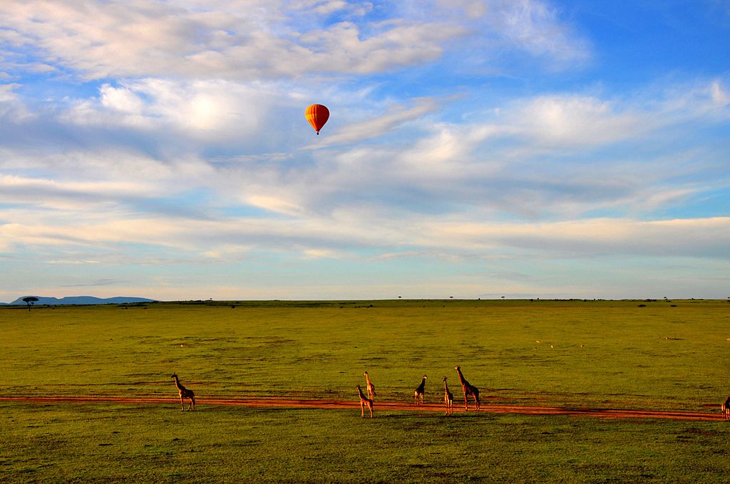 |
| hot air balloon safari |
The Maasai Mara is one of the most famous safari destinations in Africa. Entry fees are currently US$ 70 for adult non-East African Residents per 24 hours (if staying at the property inside the Reserve) or US$ 80 if outside the reserve, and $40 for children. Several lodges and tented camps are catering for tourists inside or bordering the Reserve and within the various separate Conservancies which border the main reserve. However, the main reserve is unfenced even along the border with Serengeti (Tanzania) which means there is free movement of wildlife throughout the ecosystem.
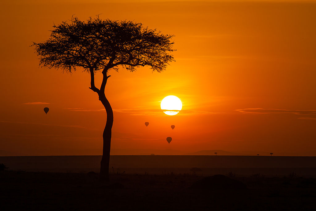 |
| Hot air balloons over Maasai Mara at sunrise |
7. Ngorongoro Conservation Area (Tanzania)
The Ngorongoro Conservation Area is a protected area and a World Heritage Site located 180 km (110 mi) west of Arusha in the Crater Highlands area of Tanzania. The area is named after Ngorongoro Crater, a large volcanic caldera within the area. The conservation area is administered by the Ngorongoro Conservation Area Authority, an arm of the Tanzanian government, and its boundaries follow the boundary of the Ngorongoro Division of the Arusha Region.
 |
| Ngorongoro crater |
The 2009 Ngorongoro Wildlife Conservation Act placed new restrictions on human settlement and subsistence farming in the Crater, displacing Maasai pastoralists, most of whom had been relocated to Ngorongoro from their ancestral lands to the north when the British colonial government established Serengeti National Park in 1959.
The name of the crater has an onomatopoeic origin; it was named by the Maasai pastoralists after the sound produced by the cowbell (ngoro ngoro). Based on fossil evidence found at the Olduvai Gorge, various hominid species have occupied the area for 3 million years.
.jpg/1024px-Ngorongoro_view_(28_12_2010).jpg) |
| Ngorongoro from inside the crater |
Hunter-gatherers were replaced by pastoralists a few thousand years ago. The Mbulu came to the area about 2,000 years ago and were joined by the Datooga around the year 1700. Both groups were driven from the area by the Maasai in the 1800s
 |
| Ngorongoro Crater is a well-known tourist attraction |
8. Morocco
Morocco is a country located in the Maghreb region of North Africa. It overlooks the Mediterranean Sea to the north and the Atlantic Ocean to the west and has land borders with Algeria to the east and the disputed territory of Western Sahara to the south. Morocco also claims the exclaves of Ceuta, Melilla, and Peñón de Vélez de la Gomera (all of which are under Spanish jurisdiction) and several small Spanish-controlled islands off its coast. The capital is Rabat and the largest city is Casablanca. Morocco spans an area of 710,850 km2 (274,460 sq mi) and has a population of over 37 million.
 |
| Sahara |
In the second half of the 1980s and the early 1990s, between 1 and 1.5 million Europeans visited Morocco. Most of these visitors were French or Spanish, with about 100,000 each from Britain, Italy, Germany, and the Netherlands. Tourists mostly visited large beach resorts along the Atlantic coast, particularly Agadir. About 20,000 people from Saudi Arabia visited, some of whom bought holiday homes. Receipts from tourism fell by 16.5% in 1990, the year the Gulf War began. In 1994, Algeria closed its border with Morocco after the Marrakech attack, which caused the number of Algerian visitors to fall considerably; there were 70,000 visitors in 1994 and 13,000 in 1995, compared to 1.66 million in 1992 and 1.28 million in 1993. In 2017, there were 10.3 million tourist arrivals, compared with about 10.1 million in 2016, a 1.5% year-over-year increase. 30% of the tourists were one of the 3.8 million Moroccans living abroad. Marrakech itself had over 2 million visitors in 2017
 |
| Atlas mountains |
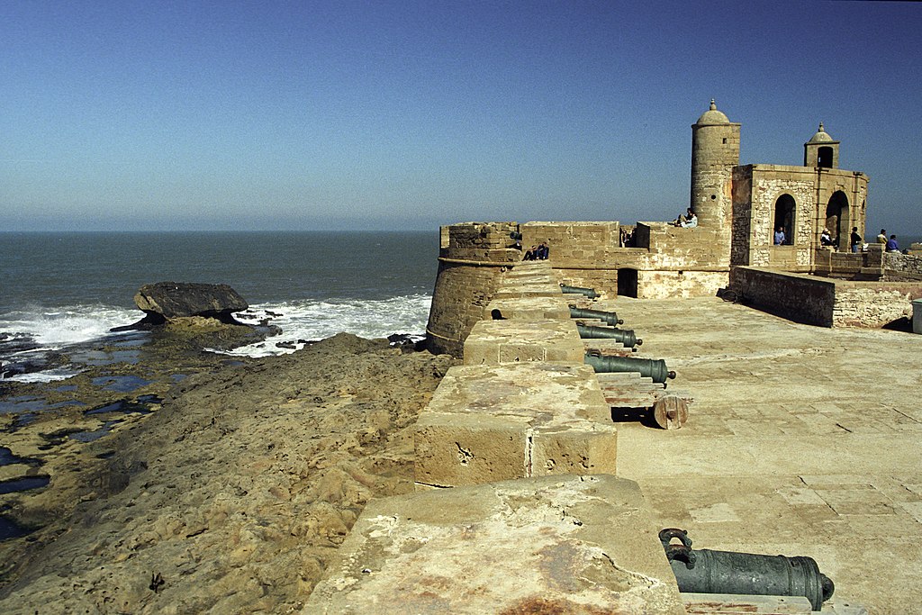 |
| Old defense walls of Essaouira |
.jpg/1024px-Ait_Benhaddou_Qsar_(588071549).jpg) |
| ksar |
 |
| Ifrane, "Morocco's Switzerland" |
 |
| beach and Kasbah at Agadir |
9. Kruger National Park
Kruger National Park is a South African National Park and one of the largest game reserves in Africa. It covers an area of 19,485 km2 (7,523 sq mi) in the provinces of Limpopo and Mpumalanga in northeastern South Africa and extends 360 km (220 mi) from north to south and 65 km (40 mi) from east to west. The administrative headquarters are in Skukuza. Areas of the park were first protected by the government of the South African Republic in 1898, and it became South Africa's first national park in 1926.
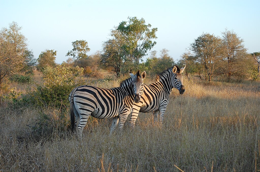 |
| Kruger National Park, South Africa |
To the west and south of the Kruger National Park are the two South African provinces of Limpopo and Mpumalanga, respectively. To the north is Zimbabwe, and to the east is Mozambique. It is now part of the Great Limpopo Transfrontier Park, a peace park that links Kruger National Park with the Gonarezhou National Park in Zimbabwe, and with the Limpopo National Park in Mozambique.
 |
| Olifants River |
The park is part of the Kruger to Canyons Biosphere, an area designated by the United Nations Educational, Scientific, and Cultural Organization (UNESCO) as an International Man and Biosphere Reserve.
The Kruger Park has the following gates:
| Crocodile Bridge Gate | on the extension of Rissikstreet | from Komatipoort | 25°21′30″S 31°53′37″E |
| Malelane Gate | on the R570 off the N4 | near Malelane | 25°27′43″S 31°31′59″E |
| Numbi Gate | on the R569 road | from Hazyview | 25°9′19″S 31°11′51″E |
| Phabeni Gate | on the road off the R536 | from Hazyview | 25°01′30″S 31°14′29″E |
| Paul Kruger Gate | on the R536 road | from Hazyview | 24°58′53″S 31°29′7″E |
| Orpen Gate | on the R531 road | from Klaserie | 24°28′33″S 31°23′27″E |
| Phalaborwa Gate | on the R71 road | from Phalaborwa | 23°56′44″S 31°9′54″E |
| Punda Maria Gate | on the R524 road | from Thohoyandou | 22°44′18″S 31°0′33″E |
| Pafuri Gate | on the R525 road | from Musina | 22°24′1″S 31°2′29″E |
10. Bwindi Impenetrable National Park (Uganda)
The Bwindi Impenetrable National Park (BINP) is in southwestern Uganda. The park is part of the Bwindi Impenetrable Forest and is situated along with the Democratic Republic of the Congo (DRC) border next to the Virunga National Park and on the edge of the Albertine Rift. Composed of 321 square kilometers (124 sq mi) of both montane and lowland forest, it is accessible only on foot. BINP is a United Nations Educational, Scientific, and Cultural Organization-designated World Heritage Site.
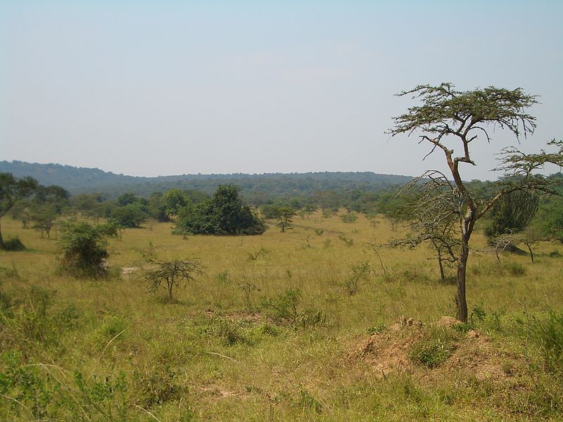 |
| Bwindi Impenetrable National Park |
Species diversity is a feature of the park. It provides a habitat for 120 species of mammals, 348 species of birds, 220 species of butterflies, 27 species of frogs, chameleons, geckos, and many endangered species. Floristically, the park is among the most diverse forests in East Africa, with more than 1,000 flowering plant species, including 163 species of trees and 104 species of ferns. The northern (low elevation) sector has many species of Guinea-Congolian flora, including two endangered species, the brown mahogany, and Brazzeia long pedicellate. In particular, the area shares in the high levels of endemisms of the Albertine Rift.
 |
| mountain gorilla |
The Bwindi Impenetrable Forest is one of the best places in the world to see mountain gorillas in their natural habitat.
11. Mauritius
Mauritius officially the Republic of Mauritius, is an island nation in the Indian Ocean about 2,000 kilometers (1,200 mi) off the southeast coast of the African continent, east of Madagascar. It includes the main island (also called Mauritius), as well as Rodrigues, Agaléga, and St. Brandon. The islands of Mauritius and Rodrigues, along with nearby Réunion (a French overseas department), are part of the Mascarene Islands. The capital and largest city, Port Louis, is located in Mauritius, where most of the population is concentrated. The country spans 2,040 square kilometers (790 sq mi) and has an Exclusive Economic Zone covering 2.3 million square kilometers
 |
| Mauritius Island |
 |
| Black River Gorges National Park |
 |
| Calcarenitic shore of Rodrigues island, at Pointe Coton |
 |
| Salomon Atoll |
12. Botswana
Botswana is a landlocked country in Southern Africa. Botswana is topographically flat, with up to 70 percent of its territory being the Kalahari Desert. It is bordered by South Africa to the south and southeast, Namibia to the west and north, and Zimbabwe to the northeast. Its border with Zambia to the north near Kazungula is poorly defined due to being in the midst of the Zambezi River. This border with Zambia is, at most, a few hundred meters long. Homo sapiens had first inhabited the country over 200,000 years ago.
 |
| 'Two Rhino' painting at Tsodilo, a UNESCO World Heritage Site |
.jpg/1024px-Okavango_Delta%2C_Botswana_(2674364913).jpg) |
| Okavango Delta |
 |
| Hotel Boat on the Chobe River, Botswana |
13. Seychelles
Seychelles officially the Republic of Seychelles is an archipelagic island country in the Indian Ocean at the eastern edge of the Somali Sea. It consists of 115 islands. Its capital and largest city, Victoria, is 1,500 kilometers (932 mi) east of mainland Africa. Other nearby island countries and territories include Comoros, Madagascar, Mauritius, and the French overseas regions of Mayotte and Réunion to the south; and the Maldives and the Chagos Archipelago (administered by the United Kingdom as British Indian Ocean Territory) to the east. Its estimated population of 98,462 is the smallest population of any sovereign African country.
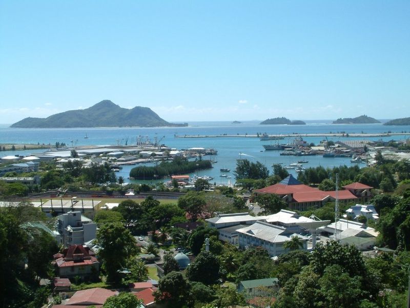 |
| Victoria, Seychelles |
 |
| Praslin, the second-largest island of Seychelles |
 |
| Beach of Anse Source d'Argent on the island of La Digue |
 |
| Mahe Island |
 |
| Beach resort, Seychelles |
14. Namibia
Namibia officially the Republic of Namibia is a country in Southern Africa. Its western border is the Atlantic Ocean; it shares land borders with Zambia and Angola to the north, Botswana to the east, and South Africa to the south and east. Although it does not border Zimbabwe, less than 200 meters (660 feet) of the Zambezi River separates the two countries. Namibia gained independence from South Africa on 21 March 1990, following the Namibian War of Independence. Its capital and largest city are Windhoek. Namibia is a member state of the United Nations (UN), the Southern African Development Community (SADC), the African Union (AU), and the Commonwealth of Nations.
.jpg/800px-Namib_Desert_Namibia(2).jpg) |
| Sand dunes in Namibia, Namibia |
The driest country in Sub-Saharan Africa, Namibia has been inhabited since early times by the San, Damara, and Nama people. Around the 14th century, immigrating Bantu people arrived as part of the Bantu expansion. Since then, the Bantu groups, the largest being the Ovambo, have dominated the population of the country; since the late 19th century, they have constituted a majority.
 |
| Tofo beach |
.svg/800px-Africa_(orthographic_projection).svg.png)




.jpg/1024px-Low_Tide_(7886864976).jpg)


.jpg/1024px-Ngorongoro_view_(28_12_2010).jpg)


.jpg/1024px-Okavango_Delta%2C_Botswana_(2674364913).jpg)


.jpg/1024px-Lake_in_the_Forest_(9654486219).jpg)




.jpg/1024px-Ait_Benhaddou_Qsar_(588071549).jpg)


.jpg/800px-Namib_Desert_Namibia(2).jpg)
